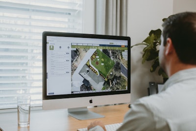
SatQuote is a cloud-based platform for desktop, tablet, and mobile developed to help landscapers measure and map properties, estimate project labor and material needs, create landscape designs, and generate PDF quotes with map images, products, and photos that allow collaboration with customers on what and where work will be done.
SatQuote's features include:
High-resolution aerial imagery: SatQuote uses high-resolution aerial imagery and measuring tools to provide accurate property measurements remotely and waste less time driving.
AI measuring assistance: SatQuote's AI measuring helps landscapers quickly measure property features such as lawns, buildings, driveways, and roadways.
Customer Collaboration: Share property maps and estimates via magic links, email, or SMS where customers can comment, markup, and add photos.
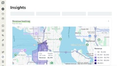
Labor and material estimation: SatQuote's labor and material estimation feature helps landscapers profitably estimate project pricing. This feature takes into account the size of the property, the type of work that needs to be done, and the cost of materials.
Landscape design & overlay: SatQuote's landscape design feature helps landscapers to create visually appealing and functional landscape designs. This feature includes a library of pre-made templates and a drag-and-drop interface that makes it easy to create custom designs. If clients already have a design, you can upload and scale it to the map to confirm accuracy and determine material and labor needs.
Estimate generation: SatQuote's estimate generation feature helps landscapers create professional-looking quotes that include scope of work, the cost of materials, and labor costs. Estimate generation syncs with Quickbooks.








![Gravely Pro Turn Mach One My23 Dsc03139 Edit 1200x800 5b2df79[1]](https://img.greenindustrypros.com/mindful/acbm/workspaces/default/uploads/2025/10/gravely-pro-turn-mach-one-my23-dsc03139-edit-1200x800-5b2df791.BucBnDoN22.jpg?ar=16%3A9&auto=format%2Ccompress&fit=crop&h=135&q=70&w=240)
